

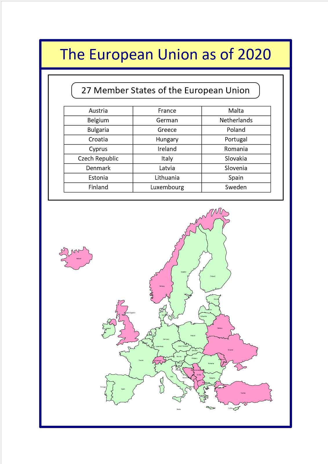
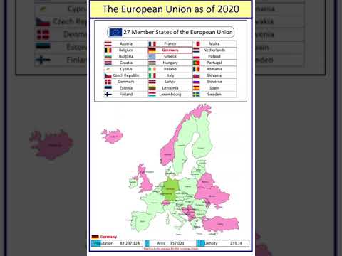
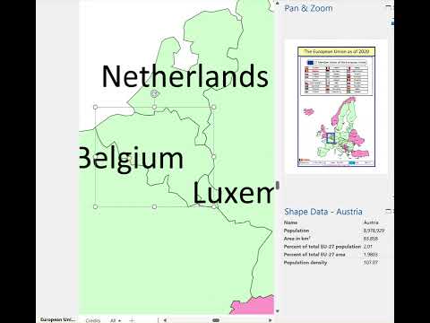
I was recently contacted by a reader, Stanley M. Max (Towson University lecturer), who had started creating a Visio map of the 27 countries in the European Union in 2020, along with the demographics culled from Wikipedia. He wanted to know if the map and stats could be combined to make a more appealing presentation. Well, that prompted me to not only combine the data and country shapes, but to explore ways in which a presentation of the map can be made more interesting in Visio. So, I added data and hyperlinks to the shapes, and set up a page property for the selected country which automatically highlights the country shape, statistics, and header, to which I added flags. So, the user can either set the page country using the Shape Data window for the page, or context menu of each country, or simply by double-clicking.


The great thing about ShapeSheet formulas is that they also work in the web browser, so the selected country can be set there too using the context menu!


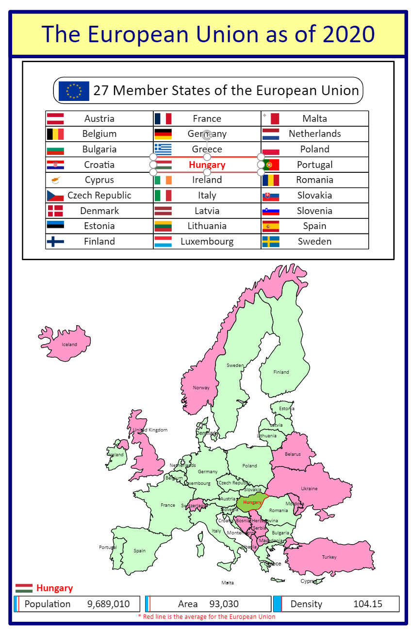
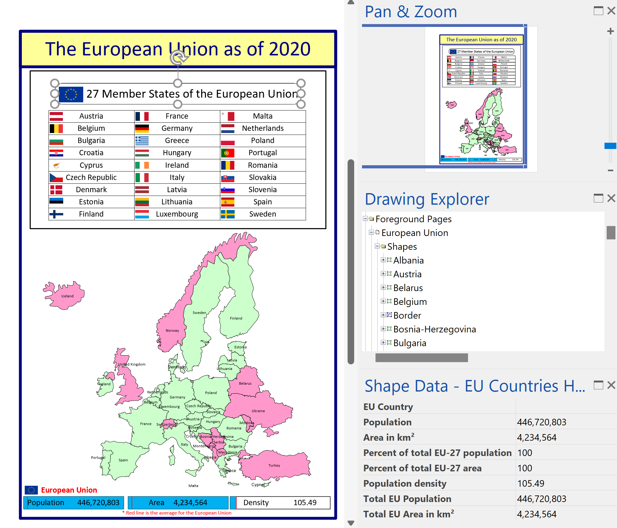
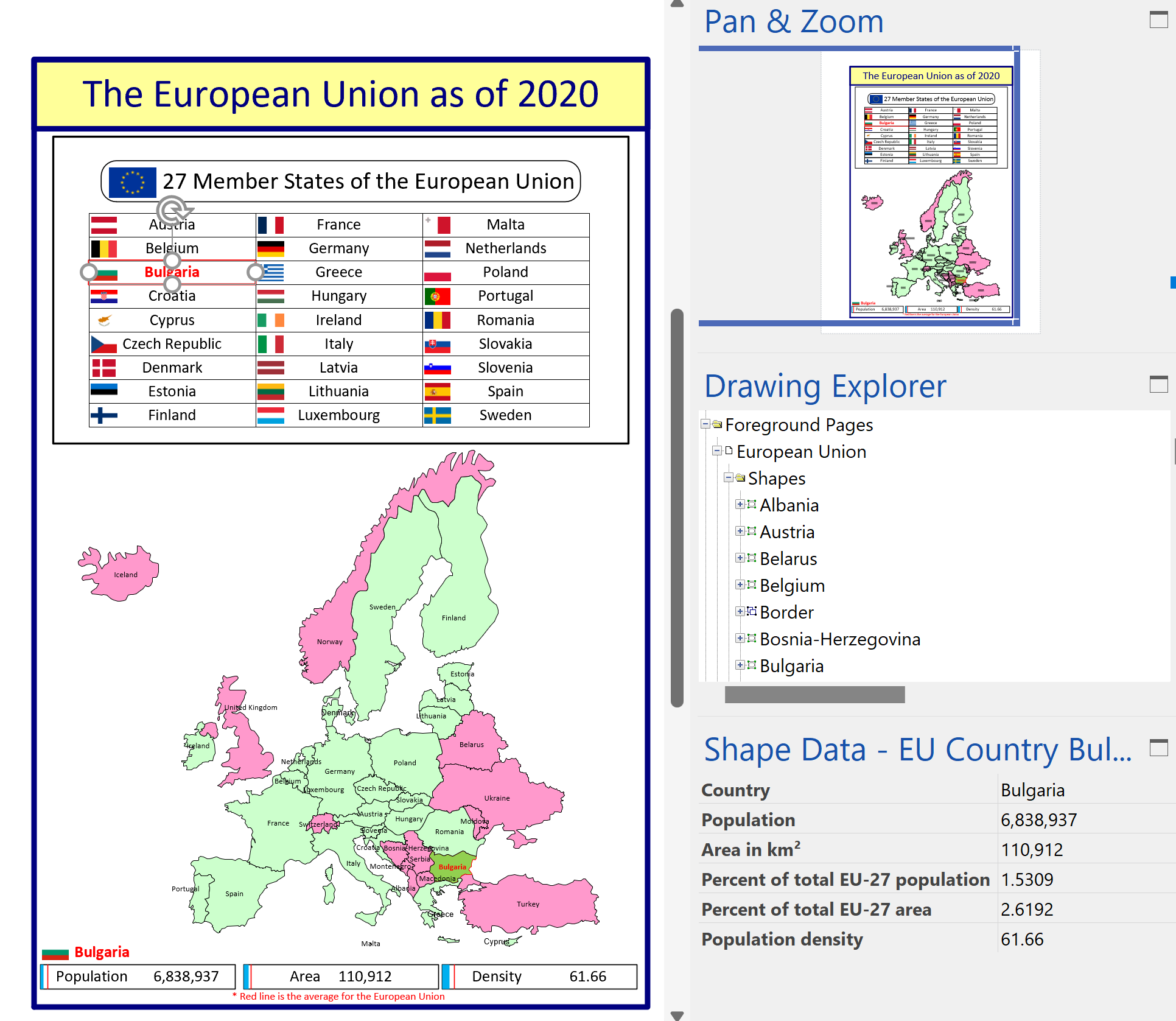
The statistic shapes along the bottom also respond to the selected country and display the population, area and density stats accordingly.
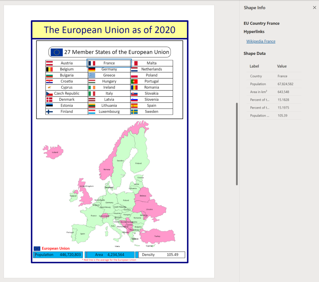
Even the ReaderView of the Visio document provides the stats and hyperlinks for each country.

I have recorded a short video to explain how the map can be interacted with in Visio.
This is the Visio document, which can be downloaded and played with:

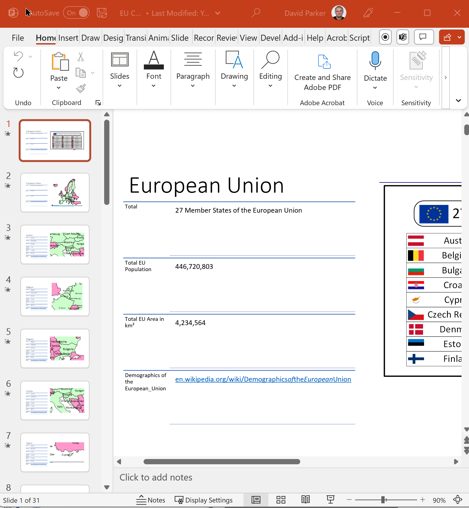
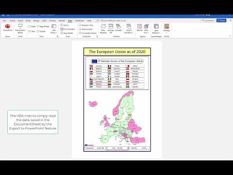
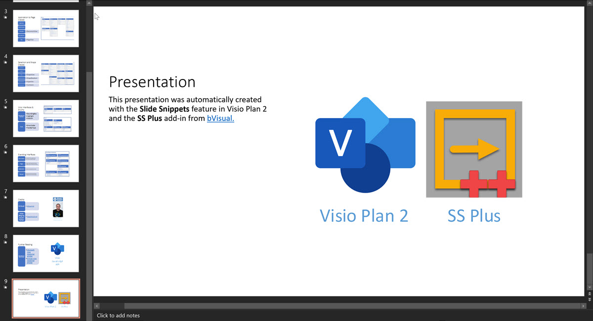
The Visio document exported to PowerPoint, augmented with SS Plus, looks like this:

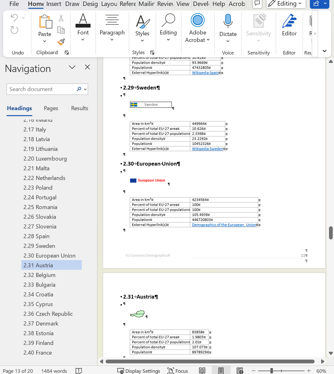
The Visio document exported to Word looks like this:
This is how the Export to PowerPoint data can be played in Visio as a presentation:
This is how the Export to PowerPoint data can be played in Visio in situ:

This is how the Export to Word data can be played in Visio:
I will explain how this can be done in future posts and will be enhancing my SS Plus add-in to include the ability to play the slide snippets within Visio too.
Credits go to Stanley M. Max for providing the original map and stats
Geographic map shapes are available from Download Geographic Map Shapes for Microsoft Visio from Official Microsoft Download Center, however these are old and do not have Malta or the newer countries, such as South Sudan.
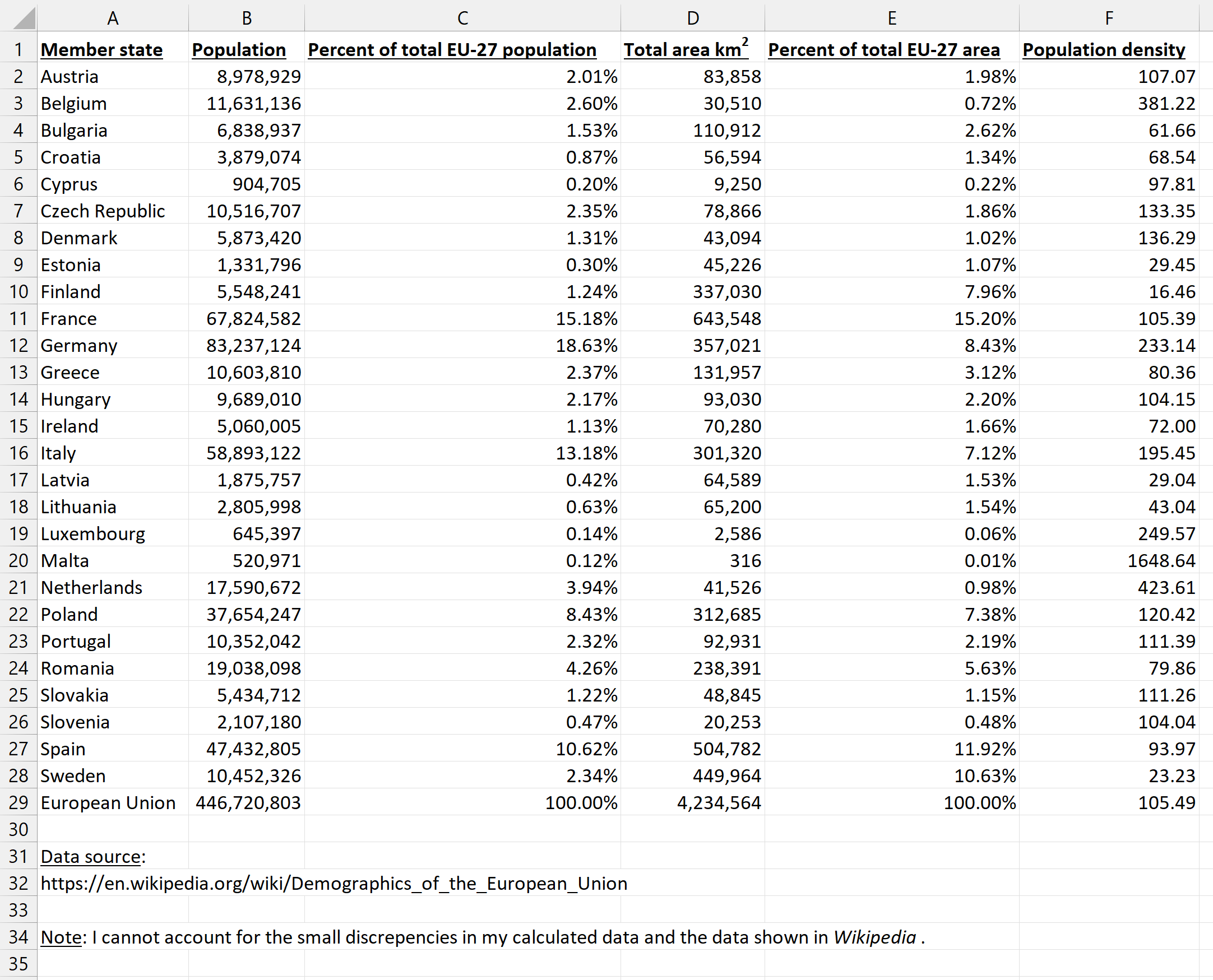
The statistics are available from Demographics of the European Union – Wikipedia.

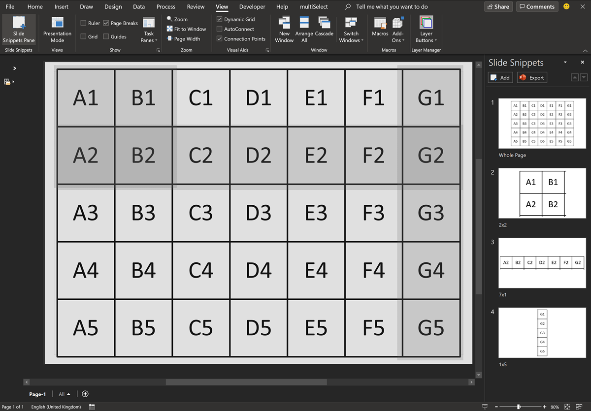
Navigate to named areas in Visio with SS Plus
Many years ago, when I was an architect, I used a Unix CAD system with large buildings. I was able to navigate quickly to rectangular areas that I had named. Well, the Export to PowerPoint feature in Visio Plan 2 provides Slide Snippets, which are named areas that can be exported to PowerPoint. My SS…

Binding Visio and Excel with Data Visualizer
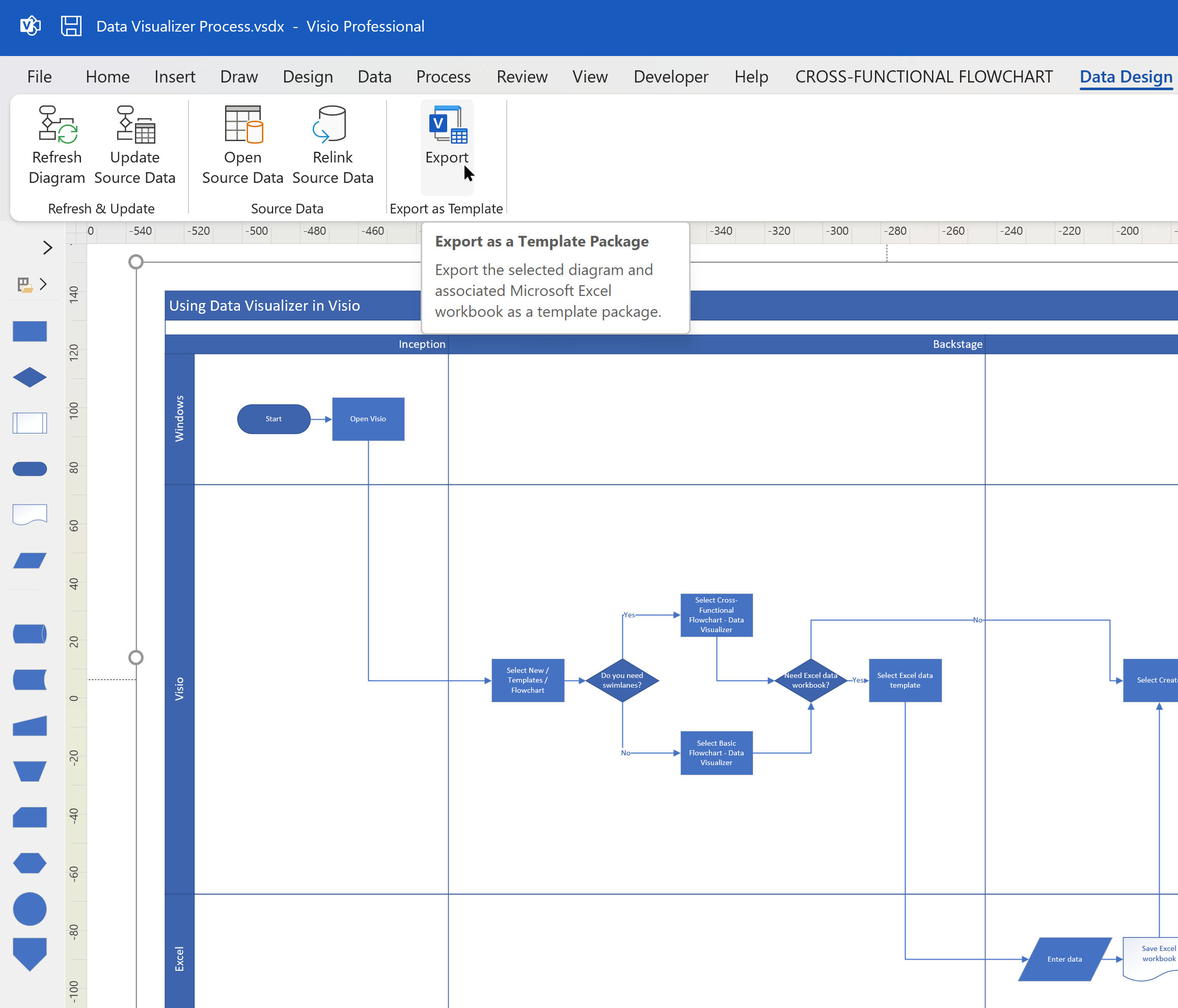
I re-vamped some of my content about the Visio Data Visualizer add-in for Excel in my last post, so I thought I should expand a bit more on the Data Visualizer feature in Visio for Desktop (Visio Plan 2) and Excel for Desktop. I have described it in detail in previous posts, but I never…

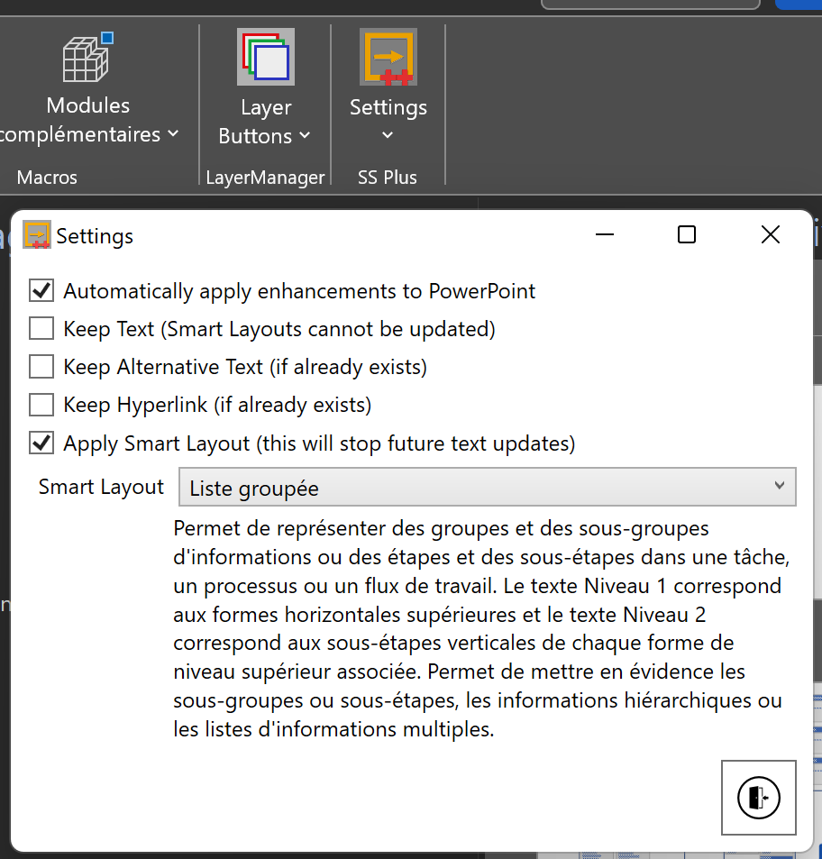
SS Plus for Visio enhanced to support non-English PowerPoint Smart Layouts
A while ago, I wrote an add-in for Visio Plan 2, SS Plus, that enhances the PowerPoint export from Visio. This has been working fine for this using Microsoft Office in English, but a problem was recently brough to my attention about non-English users. The problem was that the PowerPoint Smart Layou names are in…

Creating PowerPoint Presentations automatically from Visio
Visio Plan 2 has a great, but flawed, feature called Slide Snippets, that can create PowerPoint presentations automatically from any number of titled rectangles, on any number of pages in a Visio document. However, it usually creates distorted images, and it does not automatically contain any descriptive text or hyperlinks. I have previously described how…

Manual Fix for Slide Snippets in Visio Plan 2
Microsoft Visio Plan 2 has a cool feature, Slide Snippets, that can create a PowerPoint slide show from special rectangle shapes placed around the pages of a Visio document. Unfortunately, there is currently an issue with distortion of the images in PowerPoint, so I will show how this can be fixed manually… (more…)